


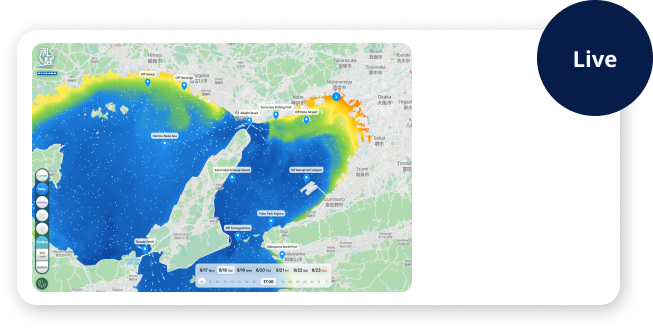
By integrating reliable ocean data provided by public agencies with our ocean forecasting algorithms, we provide ocean data that describe past conditions and forecasts.
“Phizmo”, our proprietary ocean forecasting system enables high-resolution ocean forecasts across wide geographic areas.
These data support decision-making across a wide range of sectors such as Coastal safety, Environmental monitoring, Maritime operations, Marine constructions and Marine leisure.
News
Features
-
Local area to
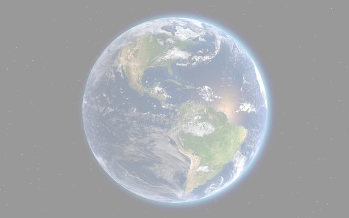
global coverageGlobal forecast data, excluding the polar regions is available. This data can be flexibly provided to suit a variety of purposes, ranging from localized data to data covering wide areas.
-
High-resolution,
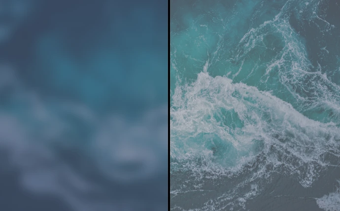
High-accuracyIn addition to high spatial and temporal resolution, Phizmo assimilates satellite observation data to provide high-precision ocean condition data that closely reflects actual ocean conditions.
-
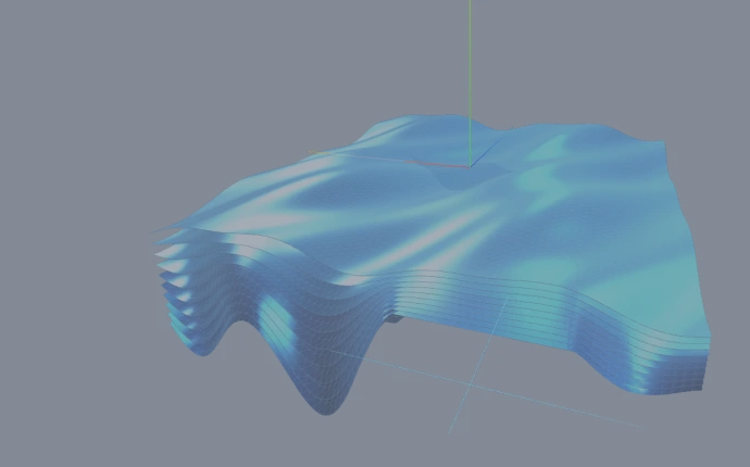
3-Dimensional data The dataset includes three-dimensional data such as water temperature, salinity, and currents, enabling advanced analysis of subsurface ocean dynamics.
-
Dataset-based
deliveryKey variables data, including water temperature, salinity, currents, and sea level, are provided in one dataset. It can reduce the effort of data collection and management and streamline analysis tasks.
-

On your own system Assisting development of your solutions by providing customized dataset, applications and system integration.
[Phizmo] Ocean forecasting system
An ocean model is simulation of ocean circulation based on physical oceanography.
It makes it possible to predict future ocean conditions, such as water temperature and current distributions, and reconstruct past conditions.
Phizmo’ key technology is its ability to import satellite observation data and perform data assimilation using proprietary algorithms. This enables the reproduction of a realistic ocean state and the generation of reliable ocean forecasts.
![[Phizmo] Ocean forecasting system](/en/ocean-forecast/lib/img/img_service_detail.webp)
Data assimilation technology
Phizmo incorporates a proprietary data assimilation algorithm that combines the NMC method, the three-dimensional variational method (3D-var) and nudging.
By integrating these methods and optimizing parameters of the algorithms for each cell, the system is capable of generating high-resolution ocean forecasts on a global scale, while also allowing for flexible adjustment of resolution to suit specific applications.
Comparison between Conventional data and Phizmo
Conventional ocean data
- Spatial resolution : 10km
- Temporal resolution : 24hours

- Spatial resolution : 3km
- Temporal resolution : 1hour (Custom resolutions are available)
Use case
-

By capturing underwater conditions in three-dimensions and high-resolution, the accuracy of analyses and simulations can be improved.
- -For validation datasets for ocean simulations.
- -Using as boundary conditions and initial value for research model.
- -Analysis of seasonal variability, eddies, and oceanic fronts
-
The forecast data can be used for coastal safety management and to monitor trend of sea conditions.
- -Monitoring coastal currents and water temperature
- -Coastal monitoring for Marina events
- -Environmental trend monitoring and reporting
-
Utilizing forecast data on currents and water temperatures for safety and efficient operations.
- -Weather routing for fuel saving
- -Safe in-harbor operation
- -Optimize voyage scheduling
-

Monitoring and forecasting sea conditions around marine constructions.
- -Safety assessment
- -Risk management for offshore operation
- -Monitoring of seasonal trends in sea conditions
-
Monitoring and forecasting for the safety of maritime activities and events.
- -Monitoring rapid changes in ocean currents
- -Feasibility assessment of maritime events
- -Supporting sport fishing activities by using water temperature and currents
-
Risk assessment and analysis of maritime accidents
- -Replaying sea conditions at the time of the maritime accident
- -Identification of high-risk areas
- -Supplemental information for marine insurance
-
Visualizing high-resolution ocean condition data as media contents.
- -Visualizing sea condition forecasts and historical data
- -Contents for Web site and SNS
- -Data source for weather routing of ship
Specifications
-
Variables
Sea water potential temperature, Sea water salinity, Sea water velocity (Northward, Eastward),Sea surface height above geoid, Sea water velocity (Upward)
-
Forecast period
5 days (hourly instantaneous values)
-
Data format
NetCDF4
-
Spatial extent
Global (excluding sea ice regions)
*Refer to coverage map for details. -
Spatial resolution
3km (latitude–longitude grid)
*Custom resolutions are available -
Elevation (depth) levels
20 vertical layers (sigma coordinates)
*Conversion formulas to depth [m] are available on the download page -
Update frequency
Once per day (around 6:00 UTC)
*Files for the same day are overwritten -
Historical data
available since 2025
-
Data access
Manual download
Specify cell(s) and period on Phizmo download page.
- -Data for a single day
- -Data for specific period (provided as a list of download URLs)
API
Requesting cells and specific period, and return download URLs including basic metadata for requested data.
Detailed specifications of parameters and response fields are provided in the documentation supplied after subscription. -
Data sources
CMEMS
- ・Ocean data:“Generated using E.U. Copernicus Marine Service Information; https://doi.org/10.48670/moi-00016”
- ・Satellite observation data (sea surface temperature) :“Generated using E.U. Copernicus Marine Service Information; https://doi.org/10.48670/moi-00165”
- ・Satellite observation data (sea level):“Generated using E.U. Copernicus Marine Service Information; https://doi.org/10.48670/moi-00149”
Weather data
“Generated using NCEP Information; https://www.nco.ncep.noaa.gov/pmb/products/gfs/”
Coastline data
“Generated using NOAA Information; https://www.ngdc.noaa.gov/mgg/dat/geodas/coastlines/LittleEndian/”
Water depth data
“GEBCO Compilation Group (2023) GEBCO 2023 Grid (doi:10.5285/f98b053b-0cbc-6c23-e053-6c86abc0af7b)”
Tidal data
The FES2022 Tide product was funded by CNES, produced by LEGOS, NOVELTIS and CLS and made freely available by AVISO. CNES, 2024. FES2022 (Finite Element Solution) Tidal model (Version 2024) [Data set]. CNES. https://doi.org/10.24400/527896/A01-2024.004"
Coverage map
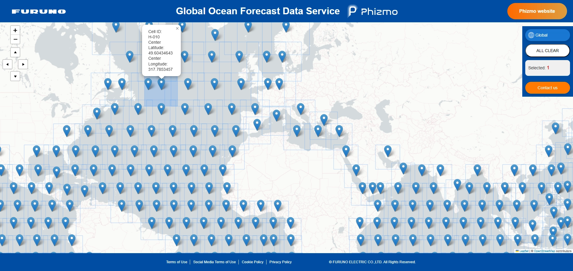
Data is provided on a per-cell basis as shown on the map
(each cell is approximately 1,000 km × 1,000 km square).
The data in each cell consists of high-resolution ocean forecasting data with approximately 3km mesh.
(Customized mesh data is available. Please contact us for details)
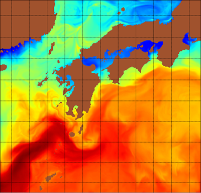
Sample data
-
Period
March 9, 2026, 00:00–23:00 (hourly) UTC
-
Data format
NetCDF4
-
Spatial extent
West of Japan region (Cell ID: A-018)
-
Spatial resolution
3km (latitude–longitude grid)
-
Elevation (depth) levels
20 vertical layers (sigma coordinates)
About the service
A. Data delivery
How to order


Contact us


Determine the specifications
Through e-mail exchange, requirements of the data to be provided is finalized. (cell, period etc.)


Initial setting
Based on the requirements, we configure the system and provide login account for the customer’s dedicated download website.

Delivery data
Retrieve data from download website or via API.
License
General license
The general license is intended for use by companies, organizations, institutions, and individuals.
The service may be used within the scope of the intended uses specified in the application form, provided that such use does not violate applicable laws, these terms of service, or any other conditions set by the Company.
Under the general license, the service may be used for purposes such as:
Examples of use
- -Internal corporate use, including analysis and evaluation
- -Research and development activities for commercial purposes
- -Integration into websites, applications, systems, or other services of derivatives created from data obtained through the service, and provision of such derivatives to third parties
Educational license
The educational license is intended for use by universities and other educational and/or research institutions and is limited to non-commercial educational and research purposes, including academic publications and conference presentations. Users who satisfy these requirements may use the service at an educational tariff.
Educational licenses do not permit use for research and development activities conducted by commercial entities, or for commercial activities conducted by universities or other educational and/or research institutions, including contract research and joint research projects sponsored by commercial entities. A general license is required for such purposes.
B. Customized development
We offer flexible solutions tailored to customer’s needs, such as customized data delivery and Apps development.
Please feel free to contact us.
Contact us
Determine the specifications
Through e-mail exchange, requirements for applications including ocean forecast data to be provided is finalized. (cell, period etc.)

System design
The proposal is made based on requirements.

Development
Customized dataset and/or application are delivered.
FAQ
-
QIn what format is the data provided?
AOcean data are provided in NetCDF format.
NetCDF is a common data format widely used in oceanographic and meteorological fields and it can be handled through specialized analysis and visualization tools or program software.
Sample data is available on the website.
In case of the service “A. Data delivery”, the data provided is raw data, instead of visualized images and/or application services.
For data visualization and system integration, we offer “B. Customized development” service. -
QDoes the dataset include wind and wave information?
AWind and wave information are not included. Our dataset primarily focuses on ocean data listed on Specifications.
-
QIs there free trial?
ASample data is available for evaluation purposes.
These datasets are intended to assist user understanding and usage. -
QIs it possible to reuse / redistribute the data?
AWithin the scope defined in the application form, data analysis and processing is allowed.
However, there are restrictions on redistributing the original raw data to third parties.
Specific terms and conditions will be provided upon inquiry. -
QHow accurate is Phizmo ocean forecasting system?
AOur “Global Ocean Forecast Data Service” uses proprietary data assimilation algorithms to incorporate various observational datasets into the forecast model. As a result, it provides forecasts that closely reflect actual ocean conditions.
Furthermore, our forecast data is improved by cross-checking it daily with satellite-based sea surface temperature data.
